Trail Cycle Val d'Anast - Circuit vélo de Maure de Bretagne - Photo

Circuit vélo de Maure de Bretagne

 tracegps
tracegps

User

© OpenStreetMap contributors
Length
Length
36 km
Max alt
Max alt
123 m
Uphill gradient
Uphill gradient
461 m
Km-Effort
Km-Effort  
42 km
Min alt
Min alt
21 m
Downhill gradient
Downhill gradient
457 m
Boucle
Boucle
Yes
Creation date :
2014-12-10 00:00:00.0
Updated on :
2014-12-10 00:00:00.0

(0 Reviews)

Cycle
Cycle
2h00
Difficulty : Medium

Scan this QR Code to open this trail in the SityTrail application

FREE GPS app for hiking

Logo SityTrail SityTrail

IGN / Geographical institutes

Download SityTrail from the App Store Download SityTrail from Google Play

Logo SityTrail SityTrail World

The world is yours!

Download SityTrail from the App Store Download SityTrail from Google Play Download SityTrail on Huawei AppGallery

About

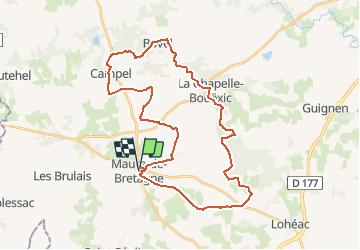
Trail Cycle of 36 km to be discovered at Brittany, Ille-et-Vilaine, Val d'Anast. This trail is proposed by tracegps.

Description

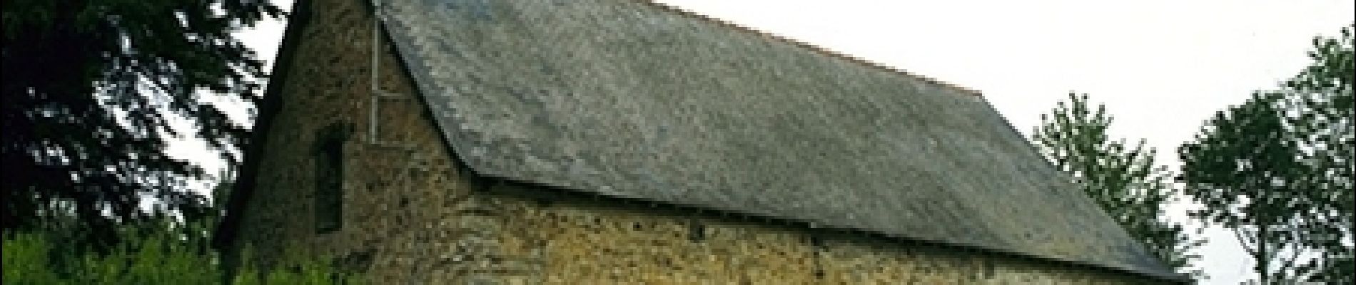
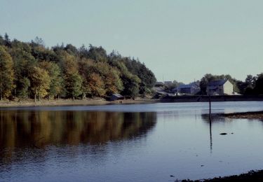
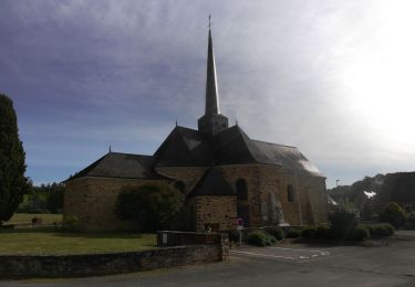
Circuit proposé par la maison du tourisme du Pays de Redon et Rando Breizh . Départ du parking du presbytère à Maure de Bretagne. Depuis Maure de Bretagne, vous sillonnez la campagne en direction de la Chapelle Saint-Mathurin, puis vers Campel. Le passage au Musée Secrets de Soie est incontournable pour plonger dans l’univers de la soie. A Bovel, rejoignez l’étang avant de descendre vers la Chapelle-Bouëxic et son château. La balade se prolonge le long du bois de Courrouët. Après La Bessonnais, possibilité de faire un détour de 3 km aller-retour, pour découvrir la Chapelle de Joie. La dernière montée annonce la chapelle des Domaines, bâtie sur un promontoire. Le retour se fait sans se fatiguer, par la voie verte, sécurisée et aménagée entre Guer et Guipry. Retrouvez le plan et le descriptif sur le site de Rando Breizh.

Elevation profile

Photos

Positioning

Country:
France
Region :
Brittany
Department/Province :
Ille-et-Vilaine
Municipality :
Val d'Anast
Location:
Unknown
Start:(UTM)
575531 ; 5304710 (30T) N.

Trails nearby

Trail On foot La Chapelle-Bouëxic - Le Chêne au Loup - Photo
On foot
PRO

On foot

Easy
La Chapelle-Bouëxic, Brittany, Ille-et-Vilaine, France
15.2 km | 17.9 km-effort
4h 4min
Yes
Trail Walking La Chapelle-Bouëxic - 07052021 la Chapelle bouexic - Photo
Walking
chasle

Walking

Easy
La Chapelle-Bouëxic, Brittany, Ille-et-Vilaine, France
23 km | 27 km-effort
5h 26min
Yes
Trail Walking Mernel - MERNEL / BOIS DE COURROUET  13 01 2019 - Photo
Walking
limase

Walking

Very easy
Mernel, Brittany, Ille-et-Vilaine, France
11.2 km | 13 km-effort
2h 56min
Yes
Trail On foot Mernel - SityTrail - Reco Merkel - Photo
On foot
elieb

On foot

Very easy
Mernel, Brittany, Ille-et-Vilaine, France
12.5 km | 14.3 km-effort
Unknown
Yes
Trail Walking Mernel - Circuit du Bois de Courrouët - Mernel - Photo
Walking
tracegps

Walking

Medium
Mernel, Brittany, Ille-et-Vilaine, France
11.1 km | 12.9 km-effort
2h 45min
Yes
Trail Walking Mernel - Reco Merkel - Photo
Walking
elieb

Walking

Medium
Mernel, Brittany, Ille-et-Vilaine, France
12.5 km | 14.3 km-effort
2h 39min
Yes
Trail Walking La Chapelle-Bouëxic - SityTrail - 18/02/2017 -.LA CHAP.BOUEXIC.Nord et Sud.Virtuel  - Photo
Walking
chasle

Walking

Very difficult
La Chapelle-Bouëxic, Brittany, Ille-et-Vilaine, France
29 km | 36 km-effort
7h 45min
Yes
Trail Walking Mernel - la Chapelle Bouexic  - Photo
Walking
Ren Nau

Walking

Very easy
Mernel, Brittany, Ille-et-Vilaine, France
10.8 km | 12.8 km-effort
2h 27min
No
Trail Walking La Chapelle-Bouëxic - 18/02/2017 -.LA CHAP.BOUEXIC.Nord et Sud.Virtuel2  - Photo
Walking
babeth35

Walking

Very easy
La Chapelle-Bouëxic, Brittany, Ille-et-Vilaine, France
29 km | 36 km-effort
5h 49min
Yes


Close
My subscriptions